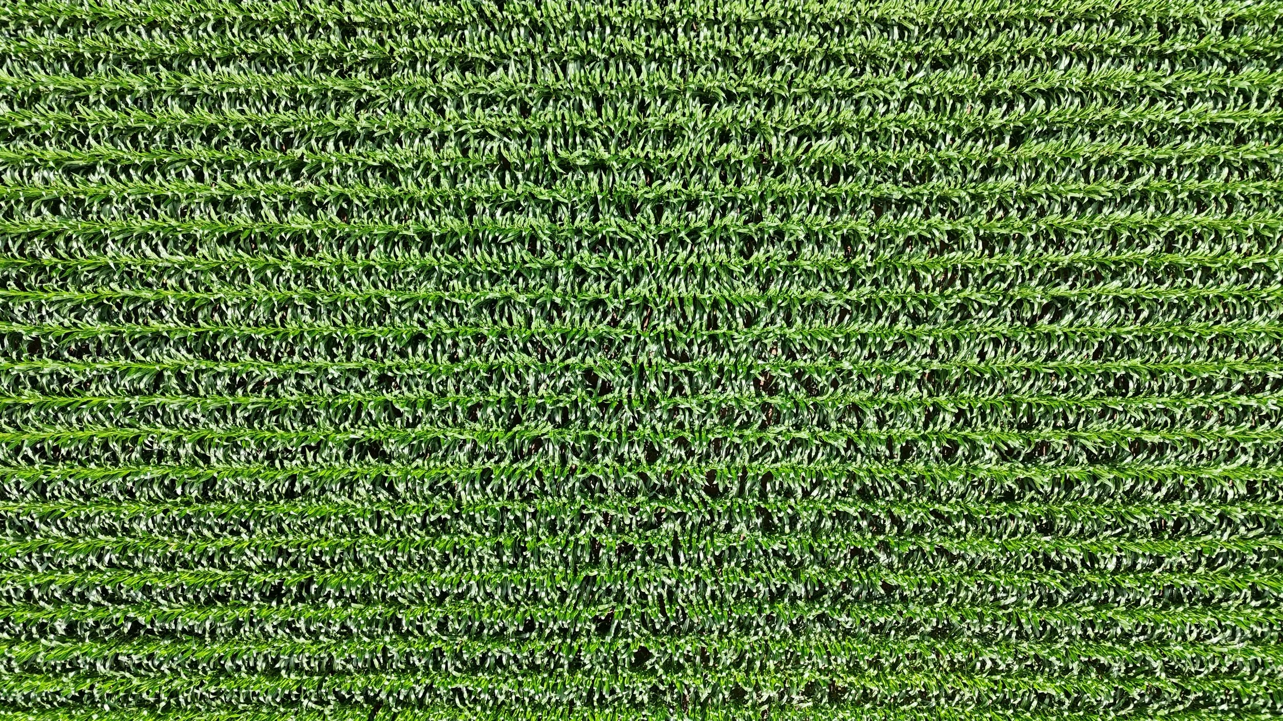
Drone Services for Farms and Agriculture
Unlock the Power of Aerial Insight. At Thumb Drone, we provide advanced drone services tailored for Michigan farms and agricultural operations. From high-resolution orthomosaic mapping and crop health visualization to visual progress tracking and field documentation, our FAA-certified drone services help you plan, monitor, and manage with confidence. With fast turnaround times and precision imagery, we deliver the data you need, when and where you need it.
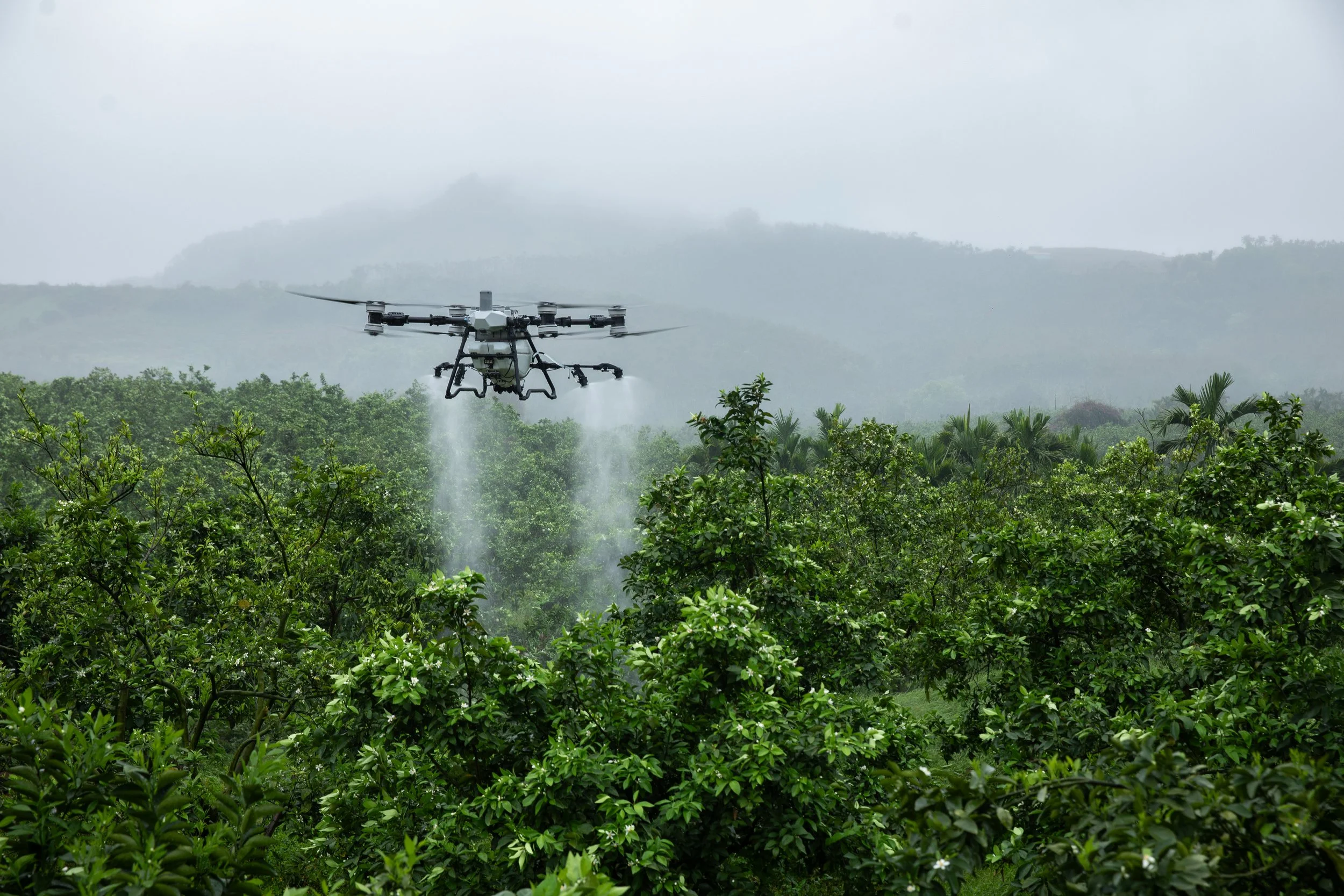
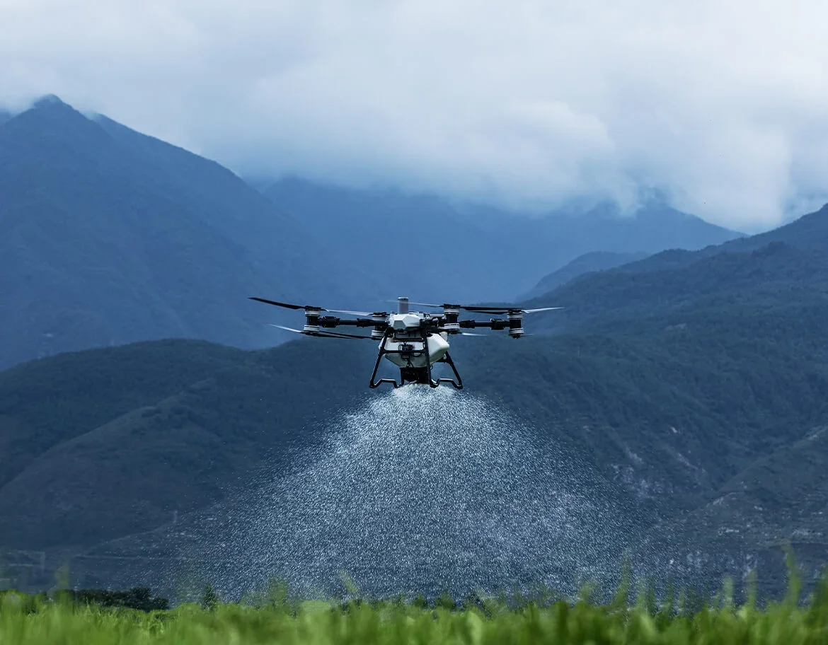
Drone Spraying Services
Our agricultural spray drones provide precise, targeted application for liquid products where traditional ground equipment or manned aircraft are inefficient, unsafe, or impractical. Drone spraying minimizes soil compaction, reduces overspray, and allows treatment of fields with obstacles or sensitive boundaries.
This service is ideal for operations that need accuracy, flexibility, and fast response times during critical application windows.
Drone Spraying Applications include:
Fungicide application on row crops
Insecticide application and targeted treatments
Herbicide spot spraying
Orchards, vineyards, and specialty crops
Fields near power lines, wind turbines, trees, or waterways
All spraying operations are performed in accordance with FAA regulations and applicable state pesticide requirements.
Drone Spreading Services
Drone spreading allows for precise aerial distribution of dry materials without heavy equipment entering the field. This method is especially effective for early-stage applications, wet conditions, or sensitive soil where ground access is limited.
Spreading missions are planned for even coverage and accurate placement based on field layout and material type.
Drone Spreading Applications include:
Cover crop seeding
Fertilizer spreading
Granular product application
Spot treatment of problem areas
Fields with limited access or irregular shapes
Drone spreading reduces compaction and provides flexibility when timing and field conditions matter most.
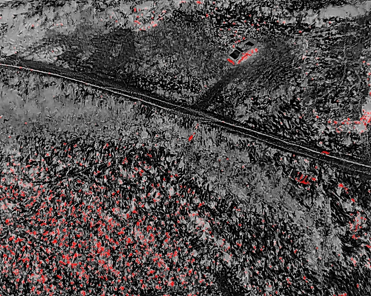
Crop Health and Thermal Imaging
Thermal imaging helps identify crop stress, irrigation issues, drainage problems, and uneven growth patterns that may not be visible from the ground. These insights allow for earlier intervention and more informed decision making throughout the growing season.
Thermal data is collected using professional-grade sensors and reviewed alongside standard aerial imagery for added context.
Use cases:
Irrigation and drainage assessment
Early detection of stressed crop zones
Moisture variability analysis
Stand health evaluation
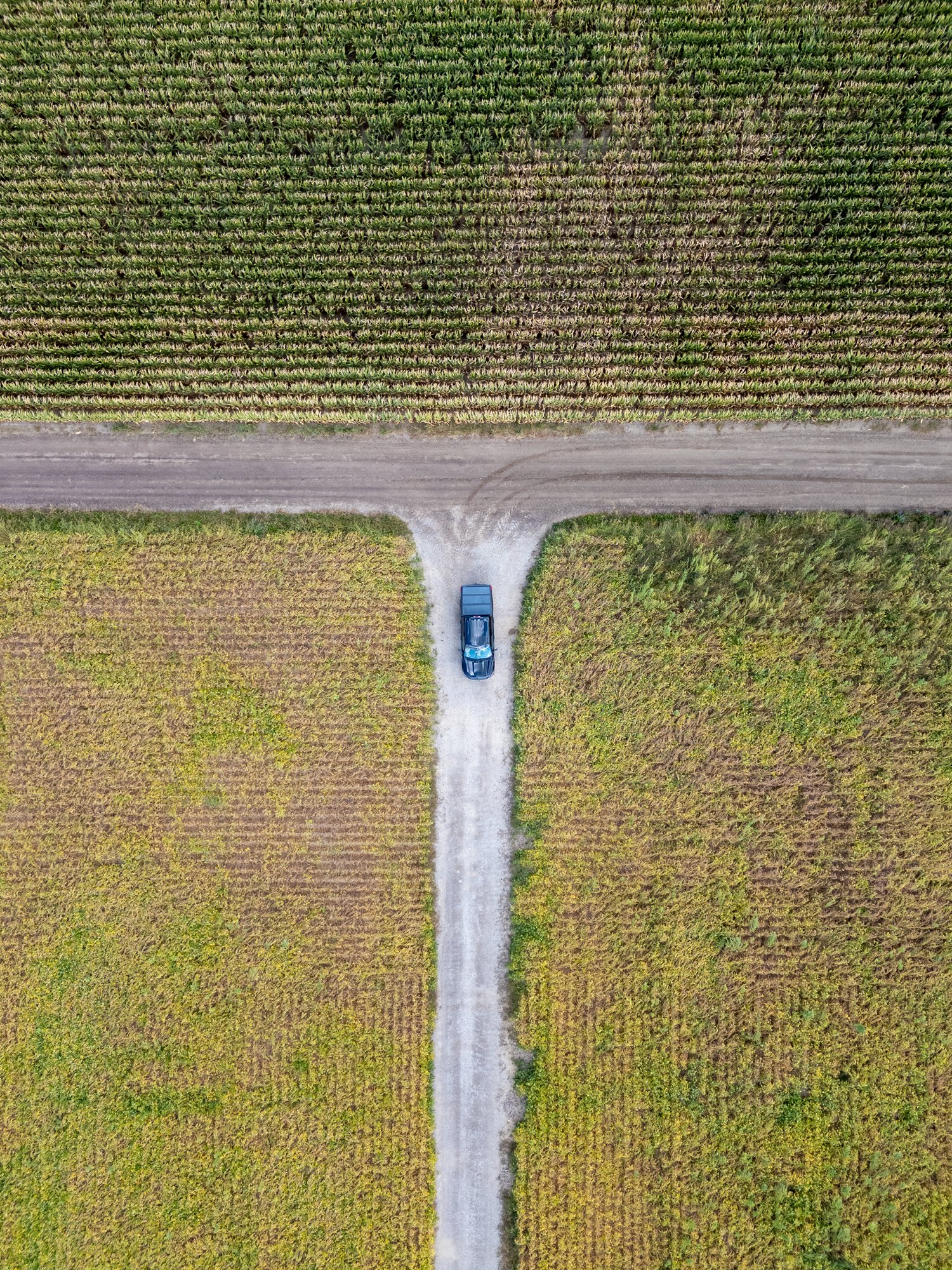
Orthomosaic Mapping and Field Measurement
We produce high-resolution, georeferenced orthomosaic maps that provide a true overhead view of your fields. These maps are useful for planning, record keeping, crop rotation decisions, and collaboration with agronomists or consultants.
Deliverables are available in multiple formats to integrate with existing workflows.
Use cases:
Acreage verification
Field boundary mapping
Drainage and water flow visualization
Year-over-year comparison
Progress Tracking and Field Documentation
Scheduled drone flights create a visual record of crop development across the season. This documentation supports planning, insurance needs, and post-season review while giving you consistent visibility into field conditions.
Use cases:
Planting and emergence documentation
Mid-season growth monitoring
Storm or weather impact assessment
Insurance and claims support
Agricultural Marketing and Media
Professional aerial photos and video help tell the story of your farm or operation. This content can be used for websites, social media, sales materials, and presentations.
Ideal for farms involved in agritourism, direct sales, co-ops, or investor-facing operations.
Use cases:
Farm branding and storytelling
Website and social media visuals
Promotional video content
Partner and investor presentations
Ready to put drones to work on your farm?
Whether you need spraying, spreading, mapping, monitoring, or marketing support, Thumb Drone LLC can build a solution tailored to your operation.