Thermal Drone Imaging Services
See What Standard Cameras Cannot. Thermal drone imaging captures temperature differences that are not visible to standard cameras. At Thumb Drone LLC, we provide professional thermal drone imaging services to support inspections, monitoring, documentation, and thermal-assisted search operations across agricultural, commercial, industrial, and municipal environments.
All thermal flights are conducted by FAA Part 107 certified and insured pilots using professional-grade thermal sensors. Our focus is on safe operations, accurate thermal data capture, and clear visual deliverables without providing diagnostic or engineering conclusions.
Thermal Inspections
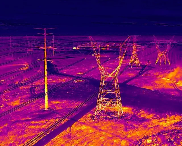
Thermal drone imaging supports visual inspections by identifying temperature variations that may indicate inefficiencies, irregularities, or areas requiring further review by qualified professionals. Drone-based thermal inspections allow large areas and elevated assets to be documented quickly without physical access or operational disruption.
Common applications include:
Roof and building envelope inspections
Electrical equipment and infrastructure documentation
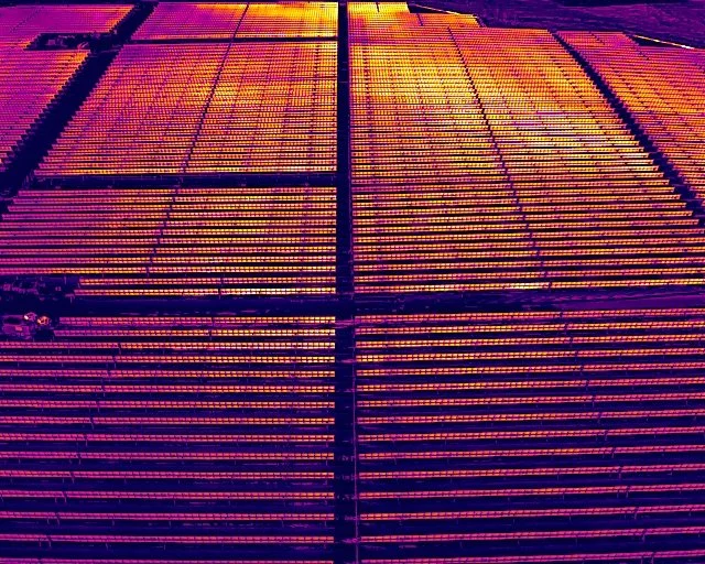
Solar panel and renewable energy inspections
Industrial facilities and mechanical systems
Agricultural structures and irrigation systems
Thermal Data Collection
Thermal imagery is provided alongside standard visual imagery to help document site conditions and provide context. Deliverables are designed to be easily shared with contractors, engineers, facility managers, or other licensed professionals for further evaluation if needed.
Available deliverables include:
Radiometric thermal images
Paired thermal and RGB imagery
Annotated image sets
PDF summaries for documentation
Raw thermal files upon request
Thermal-Assisted Search Services
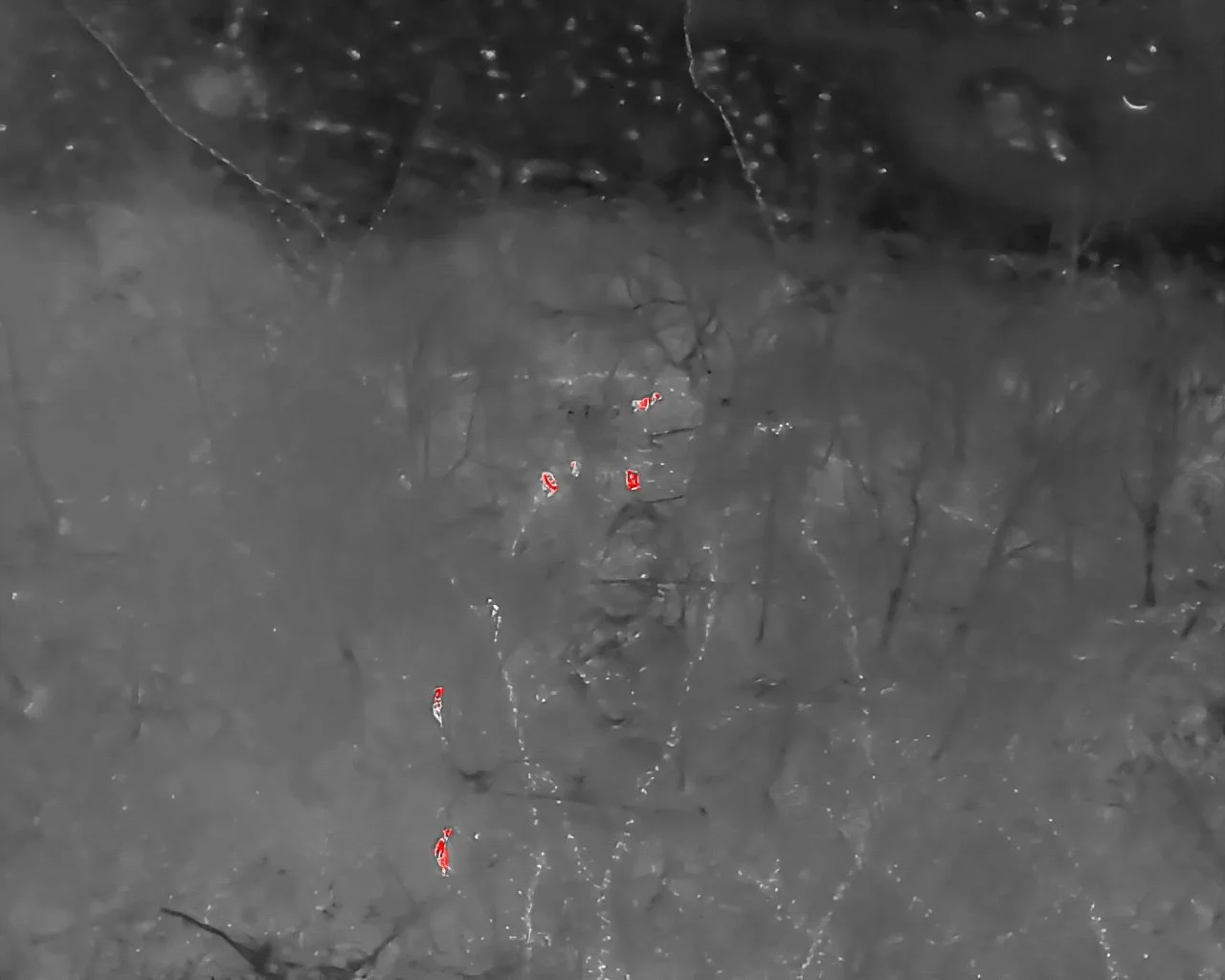
Thermal drones can assist in locating warm-blooded subjects in areas where visibility is limited. This includes lost pet recovery and other search support scenarios where thermal contrast may aid visual detection.
All thermal-assisted search flights prioritize safety, coordination, and responsible use of the technology.
Agricultural Thermal Imaging
Thermal drone imaging can support agricultural operations by documenting irrigation patterns, drainage issues, and crop stress indicators that may not be visible from the ground. This service is often paired with visual imagery or orthomosaic mapping to provide a broader view of field conditions.
Applications include crop monitoring, irrigation assessment, and seasonal documentation.