Michigan Drone Services
At Thumb Drone , we provide a comprehensive range of professional drone services designed to support agriculture, construction, real estate, inspection, and specialized operations across Michigan. All flights are conducted by FAA Part 107 certified and insured pilots using a modern drone fleet built for precision data capture, safety, and reliability.
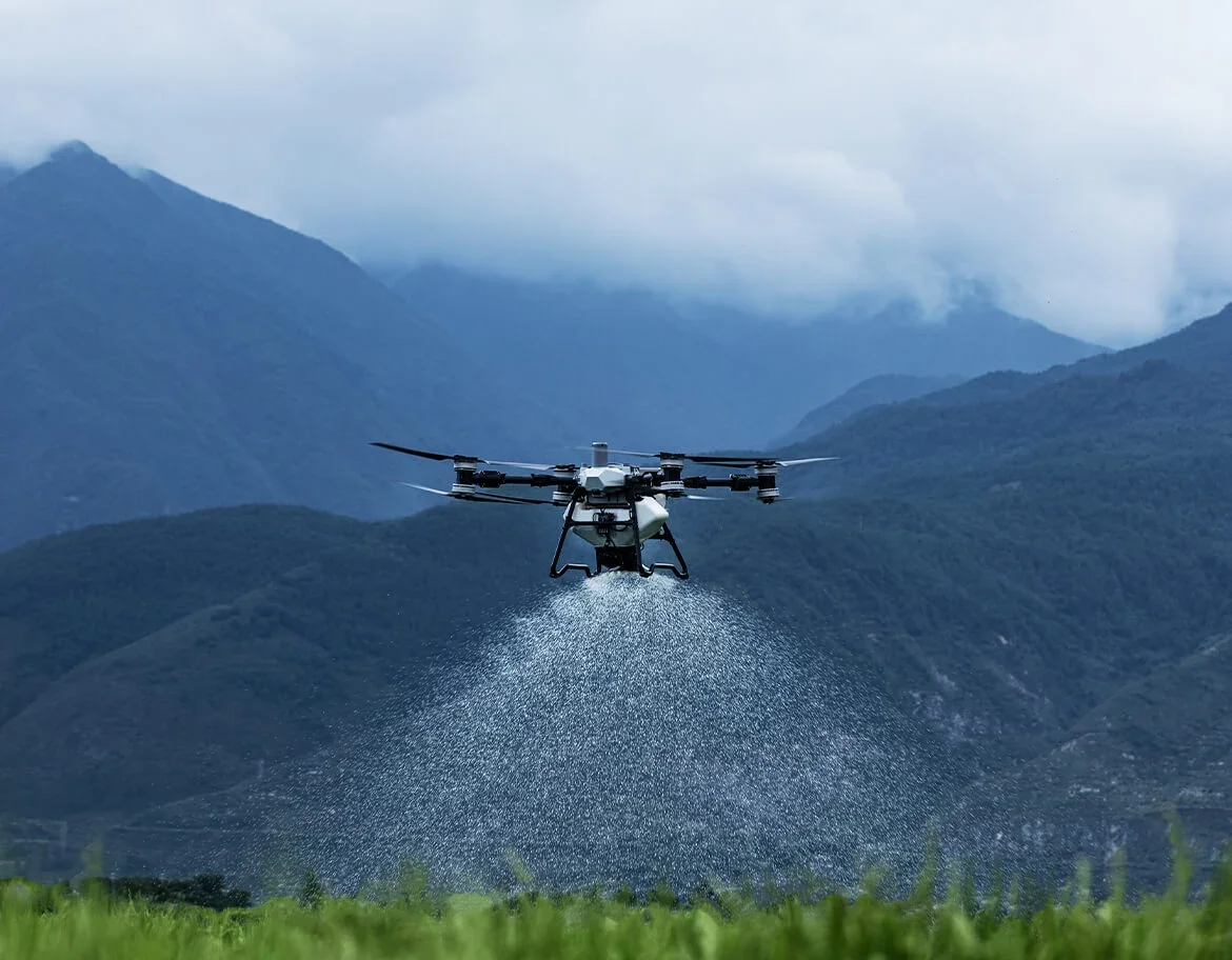
Our Agricultural Drone Services support modern farming operations through precision spraying and spreading, crop monitoring, thermal drone imaging, and high-resolution field mapping. These services help producers improve efficiency, reduce soil compaction, and make informed decisions throughout the growing season.
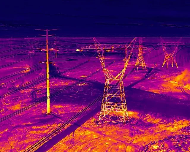
We offer Thermal Drone Imaging Services to capture temperature differences that are not visible to standard cameras. Thermal imaging supports inspections, monitoring, documentation, and thermal-assisted search services across agricultural, commercial, industrial, and municipal environments. All thermal flights focus on accurate data collection and responsible use of the technology.
Our Orthomosaic Mapping and 3D Modeling services deliver accurate, high-resolution maps and models for agriculture, construction, land development, and real estate. These deliverables support planning, measurement, progress tracking, and long-term documentation.
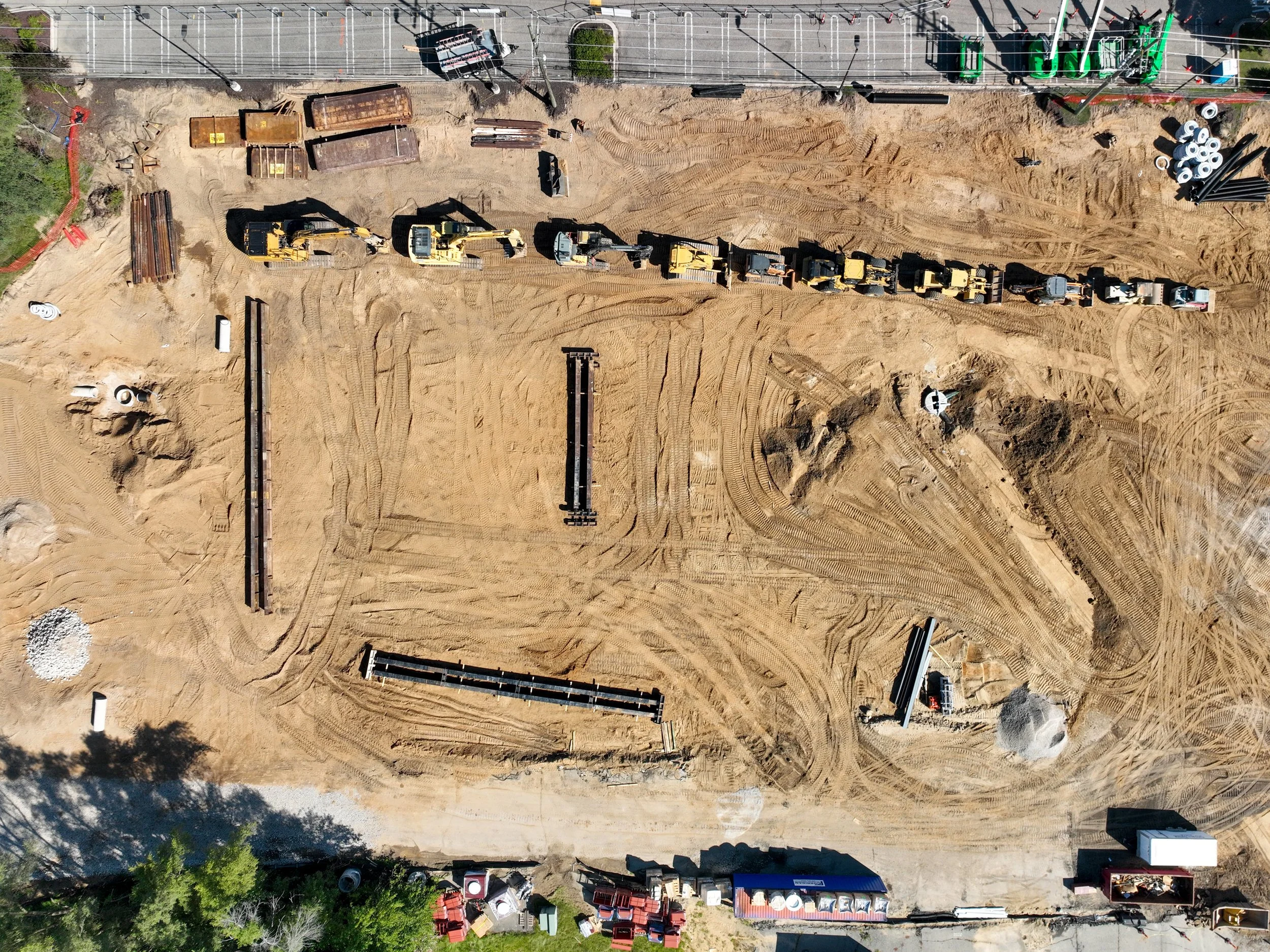
Thumb Drone LLC also provides Construction and Industrial Drone Services, including site progress monitoring, visual inspections, mapping, and documentation. These services help project teams improve communication, maintain accurate records, and monitor site conditions throughout the lifecycle of a project.
For specialized and time-sensitive situations, we offer Search and Recovery Assistance, including lost pet recovery and thermal-assisted search support in low-visibility conditions. These services prioritize safety, coordination, and responsible operations.
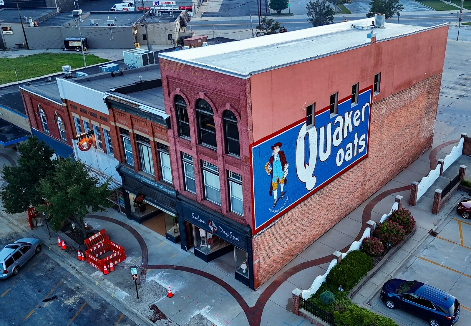
We continue to provide Real Estate and Private Property Photography, capturing professional aerial photos and video that showcase properties from unique perspectives for marketing, sales, and documentation purposes.
Whether you need actionable aerial data, reliable documentation, or compelling visual media, Thumb Drone delivers professional results backed by experience, advanced technology, and a commitment to safety and quality.
Agricultural Drone Services
Our agricultural drone services support modern farming operations through precision spraying and spreading, crop monitoring, thermal drone imaging, and high-resolution field mapping. These services help reduce soil compaction, improve application accuracy, and provide better visibility into field conditions throughout the growing season. Designed for row crops, orchards, vineyards, and specialty agriculture.
Thermal Drone Imaging
Thermal drone imaging captures temperature differences that are not visible to standard cameras. This service supports inspections, monitoring, documentation, and thermal-assisted search services across agricultural, commercial, industrial, and municipal environments. All thermal flights focus on accurate data collection and responsible use of the technology.
Construction and Industrial
Our construction and industrial drone services provide visual documentation, progress tracking, inspections, and mapping for active job sites and facilities. High-resolution aerial imagery and mapping deliver clear visibility into site conditions, helping teams improve communication and maintain accurate records. Ideal for construction, infrastructure, and industrial operations.
Real Estate Photography
Showcase your properties with professional aerial photography that highlights key features, layout, and surrounding context. High-resolution drone photos and video help realtors, developers, and property owners elevate their listings and stand out in competitive markets. Ideal for residential, commercial, and vacant land marketing.

Special Event Coverage
Capture the energy and scale of community festivals, sporting events, private celebrations, and public gatherings with professional drone aerial coverage. Our event services provide dynamic visuals that document atmosphere, crowd flow, and venue layout from unique perspectives. Perfect for promotion, recap videos, and long-term marketing use.
2D/3D PROPERTY MAPPING
Thumb Drone captures high-accuracy aerial data using RTK-enabled imaging systems for advanced 3D modeling and digital twin creation. Multi-angle and oblique capture produce detailed reconstructions of buildings, terrain, and infrastructure for visualization, planning, and documentation. Deliverables are compatible with common GIS, CAD, and 3D viewing platforms.

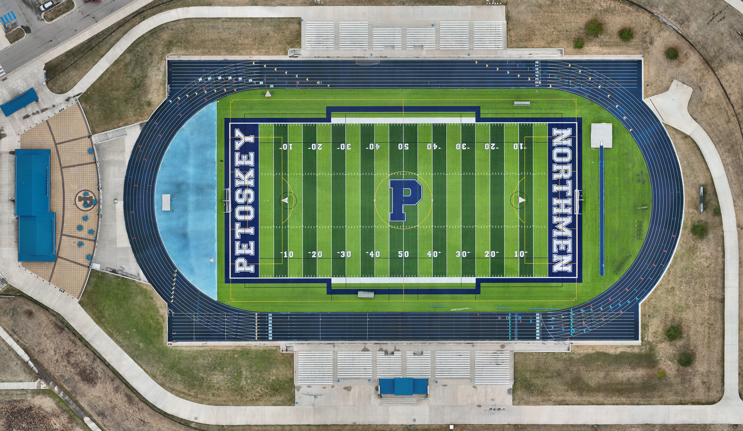
Athletic Event Coverage
Capture dynamic aerial perspectives of games, tournaments, practices, and athletic facilities. Drone coverage adds scale and context to highlight reels, promotional content, and social media while showcasing venues and team activity from unique angles. Ideal for schools, clubs, and athletic organizations.

Herd Observation
Drone imagery supports herd observation and land use documentation through non-intrusive aerial data collection. This service provides visual records of animal location, movement patterns, and general distribution across a property to support planning, monitoring, and situational awareness. Suitable for agricultural operations, large properties, and landowners seeking visual insight without disturbing animals or conducting physical interaction.

PHOTO/VIDEO PRODUCTION
Professional drone photo and video production delivers high-quality visual content for marketing, documentation, and storytelling. From commercial projects to promotional campaigns, we capture cinematic aerial visuals that elevate brands and clearly communicate scale, location, and context. Content is tailored for web, social media, and long-term use.
